


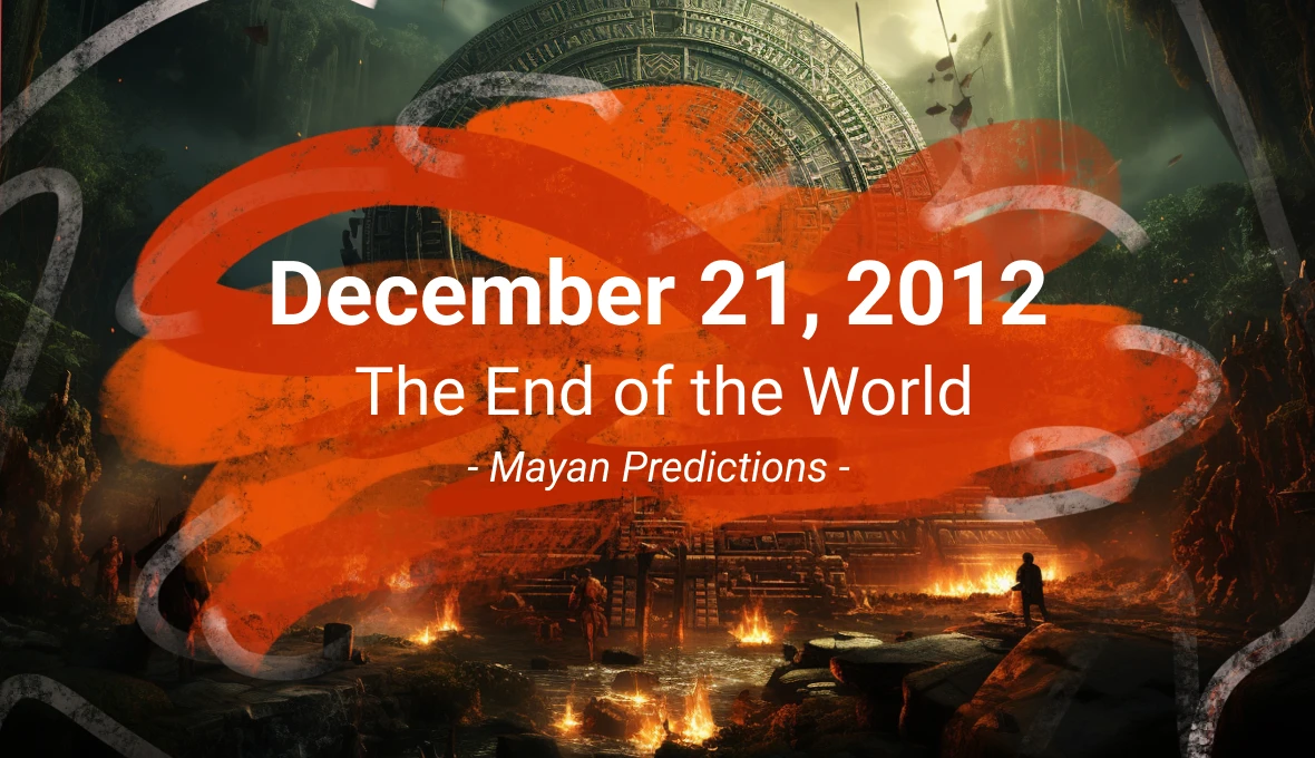
In the annals of apocalyptic predictions, few dates have generated as much anticipation and trepidation as December 21, 2012. Why? Because it marked a momentous occasion in the ancient Mayan calendar, signifying the end of an era known as the 'Long Count.' This calendar, intricately crafted by the ancient Maya civilization, was renowned for its astonishing precision in tracking time, astronomical events, and historical cycles. It was against this backdrop that the doomsday fervor ignited. Many speculated that this date would herald the conclusion of the Long Count, symbolizing not just the end of a calendar cycle but potentially the end of the world itself. This tantalizing convergence of ancient wisdom and modern uncertainty sparked a flurry of doomsday prophecies, Hollywood blockbusters, and a curious blend of apocalyptic anxiety and fascination that gripped the world. But did the world end in 2012? As we embark on this retrospective journey, it's essential to separate fact from fiction and delve deep into the heart of this phenomenon, exploring the science, history, and cultural impact of these gripping predictions.
Short Description
Within our journey, we'll delve into the roots of Mayan predictions, tracing their origin and significance while also exploring the impact of myths from that era on present-day culture. Furthermore, you'll discover how literature and cinema depicted the December 21, 2012, Apocalypse, dissecting its portrayal in artistic creations. Additionally, we'll conduct a comprehensive analysis of science's perspective on the 2012 Doomsday Prophecy, presenting a factual viewpoint. Join us on this captivating expedition through history, folklore, and scientific examination as we unveil the enduring allure and cultural reverberations of this momentous date.
The Genesis of Mayan Predictions: Unveiling Ancient Insights
In the dense jungles of the Yucatán Peninsula centuries ago, a civilization that still intrigues the modern world thrived. The Maya, a remarkable Mesoamerican culture, left behind a legacy that spans centuries, but one aspect of their heritage has particularly captured our imagination—their intricate calendar systems.
At the heart of this fascination lies the enigmatic Long Count calendar, designed with mathematical precision to track time over extended periods. It was within this labyrinth of dates and cycles that the infamous December 21, 2012, found its place.
The Maya were consummate astronomers, studying the heavens with an unparalleled zeal. Their keen observations led to the creation of the Haab', a 365-day solar calendar, and the Tzolk'in, a 260-day ceremonial calendar. But the jewel in their calendrical crown was undoubtedly the Long Count, a system that could calculate time with astonishing accuracy over millennia.
Now, what did the Mayans predict would occur on December 21, 2012? Contrary to the apocalypse predictions that seized the modern world, their inscriptions suggest not the end of the world, but a transition, a cyclical change akin to the turning of a cosmic page.
The genesis of Mayan prediction is deeply intertwined with their reverence for celestial phenomena, a testament to their sophistication in understanding the intricate dance of planets, stars, and the sun. It's this blend of mathematics, mythology, and cosmic reverence that forms the foundation of our quest to understand the 2012 prophecy.
The Mayan Calendar 2012: Unraveling Its Unique Traits
The Mayan calendar, a masterpiece of precision and mystique, beckons us to decipher its secrets, including the 'Mayan end of the world.' Unlike our common Gregorian calendar, it operated on several intertwined cycles. Imagine a symphony of time, with each calendar acting as a different instrument.

1. Haab' - The Solar Calendar: Picture 365 days, each represented by a unique day name and number, a calendar grounded in the sun's annual journey. It was the Mayan equivalent of our modern-day calendar, tracking agricultural seasons and festivals with precision.
2. Tzolk'in - The Sacred Calendar: Now add a 260-day cycle, where each day has a distinct name and number. This sacred calendar intertwined with rituals, prophecies, and divination, shaping the spiritual life of the Maya.
3. Long Count - The Cosmic Odometer: Here's the pièce de résistance - a system that counts days in remarkable spans. It's like an odometer for time, measuring thousands of years. It's within this Long Count that we discovered the end of Mayan calendar - December 21, 2012, was a significant date.
These calendars, individually remarkable, combined to create a complex matrix of time woven into the fabric of Mayan society. Each calendar brought a unique rhythm to their lives, from planting crops to conducting ceremonies.
What Were the Interpretations of December 21, 2012?
As the world hurtled toward the Mayan doomsday, a date etched in the digital stone of calendars and popular culture alike, interpretations of what it meant ran the gamut from awe-inspiring to apocalyptic.
1. Cosmic Realignment: One of the more optimistic interpretations saw December 21, 2012, as a time of cosmic realignment. Advocates of this theory believed that this date marked a rare celestial event where our solar system would align with the dark rift at the center of the Milky Way galaxy. Some thought this planetary alignment would usher in a new era of spiritual awakening and higher consciousness.
2. Doomsday Prophecies: Of course, no discussion of 2012 would be complete without the doomsday predictions. A popular interpretation, fueled by ancient prophecies and modern anxieties, foretold global catastrophe. This ranged from catastrophic natural disasters to alien invasions, all set to occur as the Mayan calendar completed its cycle.
3. Cultural Transformation: Another interpretation was less catastrophic but equally transformative. Some believed that December 21, 2012, heralded a profound shift in human consciousness. It was seen as an opportunity for personal and collective growth, a chance to leave behind old patterns and embrace a more enlightened existence.
4. Pop Culture Phenomenon: Beyond these more spiritual interpretations, December 21, 2012, became a pop culture phenomenon. It was featured in numerous books, movies, and documentaries, often embracing the doomsday angle for dramatic effect. This cultural fascination turned the date into a global talking point, further fueling the various interpretations.
5. Scientific Skepticism: On the flip side, many scientists dismissed these interpretations, including the 'last day of Mayan calendar,' as pseudoscience and fear-mongering. They argued that the Mayan calendar's end on December 21, 2012, was simply the conclusion of one cycle and the beginning of another, much like our modern calendar transitioning from December 31 to January 1 each year.
End of the World Theories Beyond the Maya for 2012
The Impending Peril: Planet X and the Nibiru Threat
Amidst the frenzy leading up to December 21, 2012, a mysterious celestial object entered doomsday discussions: Planet X, often referred to as Nibiru. Some interpretations suggested that this enigmatic planet, with the notion of 'Planet X hitting Earth,' was on a collision course with Earth, potentially causing catastrophic destruction on that fateful date.
The concept of Nibiru, including the question - Is planet Nibiru real? - draws its roots from ancient Sumerian mythology and has been revived in modern pseudoscientific circles. Some believers held that this rogue planet, lurking on the fringes of our solar system, was intentionally concealed by governments and space agencies, creating a shroud of secrecy that only added to its mystique.
Despite the lack of empirical evidence, Nibiru captured the imagination of doomsday enthusiasts. It was a celestial bogeyman lurking just beyond our vision, waiting to wreak havoc. However, as December 21, 2012, came and went without incident, the Nibiru threat joined the annals of unfulfilled apocalyptic predictions. Yet, its brief, fiery appearance on the stage of doomsday lore serves as a reminder of the power of myth and fear in shaping our perceptions of the cosmos.
Earth's Enigmatic Moves: The Polar Shift Theory
According to this theory, the Earth's poles were on the verge of a dramatic and catastrophic reversal.
Proponents of the polar shift theory, including the concept of a 'polar flip,' pointed to a variety of purported evidence, ranging from shifts in the Earth's magnetic field to geological anomalies. They suggested that such a shift would cause untold chaos: a sudden reorientation of the planet, including the possibility of a polar flip, would trigger colossal earthquakes, massive tsunamis, and worldwide disruption.
However, the scientific community largely rejected these claims. While the Earth's magnetic field does indeed fluctuate over time, a complete polar shift on the scale suggested by the theory would be an exceedingly rare event, and there was no credible scientific evidence to support the idea that it was imminent in 2012.
Nonetheless, the polar shift theory was emblematic of the kinds of speculations that can gain traction in times of uncertainty. It's a testament to the power of apocalyptic thinking to capture the human imagination, even in the face of overwhelming scientific skepticism. As we navigate the enigmatic landscape of 2012's predictions, the polar shift theory stands as a reminder of the delicate balance between scientific inquiry and speculative fascination.
Unveiling 2012: A Biblical Perspective on Deciphering the Divine
Drawing inspiration from passages in the Bible, particularly those found in the Book of Revelation, believers asserted that December 21, 2012, marked a critical juncture in the unfolding of divine prophecy, including the intriguing Bible codes prophecies. Some suggested that it could signify the onset of the biblical Apocalypse, a time of divine judgment and reckoning.
This perspective resonated with those who saw parallels between contemporary events and the prophetic imagery of scripture. Natural disasters, political upheaval, and global uncertainty fueled the belief that the world was hurtling toward a climactic showdown between good and evil.
However, as the date passed without the apocalyptic events foretold by some interpretations, including the consideration of biblical signs of end times, it prompted reflection and debate within religious communities. While the biblical perspective in 2012 didn't materialize in the catastrophic manner predicted, it did raise questions about the role of faith, prophecy, and the interpretation of ancient texts in the modern world.
Nostradamus and 2012: Unraveling Prophecies Across Time
While the Mayan calendar took center stage in the 2012 doomsday discourse, the enigmatic predictions of Michel de Nostredame, better known as Nostradamus, including his famed prophecies of Nostradamus, added an aura of mystique to the narrative. Nostradamus, a 16th-century French astrologer, and seer, is renowned for his cryptic quatrains that have intrigued interpreters for centuries.
For some, Nostradamus' writings appeared to contain veiled references to the events of December 21, 2012. His prophetic verses, which seemed to foretell global cataclysms, were dissected and reinterpreted to align with the apocalyptic expectations of the time.
However, the challenge with Nostradamus' quatrains has always been their ambiguity. They are open to myriad interpretations, and this flexibility allows them to be applied to almost any major event. The link between Nostradamus and 2012 rested heavily on creative interpretations and selective reading.
As the day came and went without the foreseen disasters, the Nostradamus 2012 prediction began to fade. Nevertheless, it underscored the human inclination to seek hidden meaning in ancient texts and prophecies, especially in times of uncertainty.
Ever Wondered What the Mayans Knew that We Didn't?
Unearth the truth about the end-of-the-world phenomenon with our expert research paper writers!
The Spread of Myths in Contemporary Culture
Beyond the realms of ancient prophecies and reversed calendars, the 2012 phenomenon had another intriguing facet: its rapid spread through contemporary culture. In an era characterized by instant communication and the proliferation of information, myths, and speculations took on a life of their own.
Society's Initial Adoption of the Prophecy in Culture
Approaching the turn of the millennium, a palpable sense of uncertainty gripped the world. The Y2K scare and the lingering impact of 9/11 cast a shadow of unease. Against this backdrop, the idea of a cataclysmic event on December 21, 2012, resonated profoundly.
The advent of the internet, a burgeoning information-sharing platform, played a pivotal role. Websites, forums, and social media accelerated the spread of the 2012 doomsday. It found a home in literature, film, and television, where it was woven into gripping narratives. Blockbuster movies like '2012' catapulted the prophecy into popular culture, sensationalizing and legitimizing it in the process.
This period reflected society's anxieties, spiritual yearnings, and an enduring fascination with ancient wisdom. It highlighted the potent interplay between cultural currents and individual beliefs. In a world awash with information and uncertainty, the 2012 prophecy became a symbol of how myths and prophecies could captivate the collective imagination and spark global discourse.
Myth's Digital Evolution
With the rise of the internet, myths and speculations found fertile ground to flourish. Online communities, blogs, and social media amplified the prophecy's reach. Viral videos, websites, and discussion forums became digital platforms for the exchange of ideas, misinformation, and fervent beliefs.
In this digital landscape, myths could evolve at warp speed. They adapted, mutated, and spread with unprecedented velocity, reshaping themselves in response to new information and interpretations. The doomsday website proliferation not only propelled the 2012 prophecy into the mainstream but also transformed the very nature of myth and belief in our interconnected world.
Furthermore, the internet was home to a special end of the world countdown ticking away to the date of the supposed end of the world. These digital clocks added an extra layer of anticipation, intensifying the global fascination and anxiety surrounding December 21, 2012. They underscored how the digital age, including this 2012 countdown, could magnify the influence of myths and shape our collective awareness.
The December 21, 2012 Apocalypse in Literary Works
The cultural fascination with the 2012 prophecy found its way into the realm of literature, where authors sought to explore, reimagine, and interpret the impending Apocalypse. Here are a few notable books from our 'write my essay' experts that delved into the subject:

- 'The Maya Codex' by Adrian d'Hage: This thriller combines elements of Mayan prophecy, archaeological intrigue, and contemporary conspiracy, offering readers a fast-paced journey into the mysteries surrounding 2012.
- 'The 12th Planet' by Zecharia Sitchin: A classic work in the ancient astronaut theory genre, Sitchin's book explores the idea that ancient Sumerian texts hold clues about extraterrestrial influences on Earth, including potential connections to the 2012 phenomenon.
- 'The End of the World' by Don Hoesel: This novel blends archaeology, prophecy, and action as it follows a protagonist's quest to uncover ancient secrets that could hold the key to the end of the world.
- 'The Mayan Resurrection' by Steve Alten: In this work of speculative fiction, Alten explores the idea that the Mayan calendar's end heralds not the Apocalypse but rather a transformation of human consciousness and a chance for redemption.
- '2012: The War for Souls' by Whitley Strieber: Strieber weaves a tale of parallel universes, cosmic battles, and spiritual transformation in the face of an impending apocalypse.
The 2012 End-of-the-World Scenario in Cinema
The 2012 end of the world phenomenon also cast a long cinematic shadow, inspiring a wave of blockbuster movies, along with history channel documentaries, that capitalized on the apocalyptic narrative. Here are some notable films that explored the world's supposed end in 2012:

- '2012' (2009): Directed by Roland Emmerich, this disaster epic became synonymous with the 2012 prophecy. It depicted a series of catastrophic events, from massive earthquakes to tsunamis, as humanity raced to survive.
- 'Seeking a Friend for the End of the World' (2012): A more understated take on the Apocalypse, this film starring Steve Carell and Keira Knightley explores human connections and relationships in the face of impending doom.
- 'Melancholia' (2011): Directed by Lars von Trier, this psychological drama used a rogue planet's collision with Earth as a backdrop to delve into the emotions and relationships of its characters.
- 'These Final Hours' (2013): This Australian film offered a unique perspective on the end times, focusing on a man's quest for redemption and human connection during Earth's final hours.
- 'The Road' (2009): Adapted from Cormac McCarthy's novel, this post-apocalyptic tale didn't focus on the 2012 prophecy but offered a haunting exploration of survival and father-son bonds in a bleak world.
Analyzing Science's Take on the 2012 Doomsday Prophecy
While the 2012 phenomenon captivated popular culture with tales of Apocalypse, scientists and researchers took a markedly different approach. They approached the subject with skepticism, critical analysis, and a firm grounding in empirical evidence. In the following section, we'll delve into the scientific perspective on the 2012 doomsday prophecy, exploring why many experts dismissed it as a baseless fear and how the scientific method provided a rational lens through which to view the purported catastrophe.
2012 End of the World: Unveiling the Celestial and Earthly Factors
To truly understand the 2012 phenomenon, one must embark on a journey that transcends myths and speculation and delves into the realms of science and celestial mechanics. Let's explore the astronomical and geological factors that shed light on why December 21, 2012, came and went without the apocalyptic scenarios predicted.
From the alignment of celestial bodies to Earth's geological stability, these factors provide a rational foundation for understanding the true nature of this momentous date. By unraveling the celestial and earthly forces at play, we can gain insight into the enduring fascination and cultural impact of the 2012 prophecy.
Celestial Factors
Astronomy and celestial mechanics play a pivotal role in understanding why December 21, 2012, didn't herald the apocalyptic events predicted by the Mayan calendar. Here are several key celestial factors that debunked the doomsday scenarios:
1. Galactic Alignment: One of the central claims surrounding 2012 was the idea of a rare galactic alignment between the Earth, the sun, and the center of the Milky Way galaxy. Proponents of doomsday theories argued that this alignment would trigger cataclysmic events. However, from an astronomical perspective, such alignments are routine occurrences and have no direct impact on Earth.
2. Solar Activity: The sun's activity, including solar flares and sunspot cycles, was another focus of doomsday predictions. Solar physicists and astronomers closely monitor the sun's behavior, and while solar activity can affect our technology, there was no scientific basis for it causing a global catastrophe in 2012.
3. Planetary Alignments: Some theories suggest that alignments of multiple planets would exert gravitational forces that could disrupt Earth's stability. However, astronomical calculations demonstrated that these planetary positions were not exceptional and posed no threat.
4. Nibiru/Planet X: As mentioned earlier, the Nibiru/Planet X hypothesis posited that a hidden supposed planet would collide with Earth. However, no credible evidence supports the existence of such a planet within our solar system.
Earthly Factors
In addition to celestial factors, understanding the 2012 phenomenon requires an examination of Earthly factors, including geological, climatic, and environmental elements, which played a significant role in debunking doomsday scenarios and the geomagnetic reversal effects.
1. Geological Stability: Contrary to predictions of massive earthquakes and tectonic upheaval, Earth's geological stability prevailed. Seismic activity in 2012 was consistent with historical averages, with no unusual spikes in earthquakes or volcanic activity that would have supported doomsday claims.
2. Climate and Natural Disasters: Doomsday scenarios often include catastrophic climate events, such as superstorms, tsunamis, or sudden ice age onset. However, Earth's climate system continued to function within normal parameters in 2012, with no evidence of the extreme events predicted.
3. Environmental Observations: The global network of environmental monitoring systems, including satellites, weather stations, and ocean buoys, reported no anomalous trends that would align with doomsday scenarios. These systems provide real-time data on the Earth's environmental conditions, offering crucial insights into any significant disruptions.
4. Scientific Consensus: Perhaps the most compelling Earthly factor was the consensus among scientists from various disciplines that the 2012 doomsday predictions lacked scientific credibility. Prominent scientific organizations and experts worldwide publicly dismissed these claims, emphasizing the importance of rigorous research and evidence-based conclusions.
Dispelling Misconceptions and Scientific Doubt
As the year 2012 drew nearer, rumors and prophecies about an impending apocalypse escalated dramatically in popular culture. However, despite the significant public interest in these notions, the scientific community largely maintained a stance of skepticism. Experts hailing from diverse fields took the initiative to disprove these myths, underscoring the paramount importance of knowledge founded on empirical evidence.
Challenging Astronomical Assertions
Within the realm of scientific doubt, challenging the astronomical assertions tied to the 2012 prophecy became a pivotal endeavor. Here's how experts addressed some of the key astronomical claims:
1. Galactic Alignment: The idea of a rare galactic alignment between Earth, the sun, and the Milky Way's center was thoroughly examined by astronomers. They clarified that such alignments are routine cosmic events, occurring approximately every 26,000 years. They emphasized that this alignment held no physical influence on Earth or its climate.
2. Solar Flares and Sunspots: Astronomers closely monitored solar activity, including the solar flare and sunspot cycles. While these phenomena can impact our technological infrastructure, there was no scientific basis to suggest that they would lead to global catastrophe in 2012. The sun operates on well-established cycles, and none of them indicates an impending disaster.
3. Planetary Alignments: The concept of destructive gravitational forces resulting from planetary alignments was scrutinized. Astronomers calculated the positions of planets and found that these alignments, including the 2012 planet alignment, were not exceptional. They reinforced that the gravitational effects of planetary positions on Earth are minimal and not associated with catastrophic events.
Rebutting Geological Hypotheses
Another crucial aspect of dispelling scientific doubt in the face of the 2012 prophecy involved examining geological hypotheses. Here's how experts addressed some of the geological claims associated with the doomsday predictions:
1. Massive Earthquakes and Tectonic Disasters: Scientists studying the Earth's geological activity provided reassurance that no extraordinary seismic events were on the horizon. They pointed to historical data, which indicated that seismic activity occurs within known patterns and is not influenced by celestial alignments or calendar milestones.
2. Climate Catastrophes: Claims of sudden ice ages, superstorms, or drastic shifts in climate were thoroughly assessed by climate scientists. Their research showed that Earth's climate is influenced by complex, long-term processes driven by factors like greenhouse gases and solar cycles. These processes do not align with the rapid, cataclysmic changes predicted for 2012.
3. Supervolcanoes: Some doomsday scenarios included supervolcanic eruptions with catastrophic global consequences. Geologists and volcanologists analyzed the stability of known supervolcanoes and found no indications of imminent, world-altering eruptions.
Evaluating Source Credibility
To fully understand why the 2012 world end predictions gained traction, it's essential to evaluate the credibility of the sources that propagated these notions. Here are key aspects of source credibility:
1. Misinterpretation of the Mayan Calendar: Much of the hysteria surrounding 2012 stemmed from a fundamental misinterpretation of the Mayan calendar. Contrary to doomsday claims, the calendar's 'end' in 2012 simply marked the completion of a cycle. This misinterpretation highlighted the importance of relying on experts in Mayan culture and archaeology for accurate information.
2. Sensationalism and Profit Motives: Many websites, authors, and media outlets contributed to the frenzy surrounding 2012, often motivated by profit. Sensationalism was rampant, with exaggerated claims and fictitious scenarios designed to attract readers and viewers. This highlighted the need for critical media literacy, encouraging the public to scrutinize sources and question sensational claims.
Education's Impact on Dispelling Myths
Amid the surge of 2012 end of the world predictions, education emerged as a powerful tool in dispelling myths and promoting scientific literacy. Here's how education played a vital role:
1. Promoting Critical Thinking: Educational institutions and programs emphasize critical thinking skills. By teaching individuals how to assess sources, evaluate evidence, and distinguish between credible information and sensationalism, education empowered people to think rationally about the 2012 phenomenon.
2. Encouraging Scientific Literacy: Science education played a crucial role in debunking the pseudoscientific claims associated with the doomsday predictions. Students learned about astronomy, geology, and other relevant fields, equipping them with the knowledge to question and evaluate the claims made by doomsday proponents.
3. Fostering Skepticism: Education nurtured a healthy skepticism, teaching individuals to ask questions and demand evidence. This skepticism was instrumental in challenging the credibility of sources that perpetuated doomsday narratives.
4. Providing Access to Experts: Educational institutions often served as conduits to experts in fields like astronomy, archaeology, and climatology. These experts were instrumental in addressing misconceptions and providing authoritative insights into the 2012 phenomenon.
If you want a more in-depth discussion about how education helps to debunk myths, feel free to send us a 'write my essay for me' request, and we'll handle it for you.
Public Response and Its Ramifications
The specter of the 2012 apocalypse prophecy left a profound imprint on global society, sparking a wide spectrum of reactions that ranged from personal preparations to community events. These responses, stemming from fear, curiosity, or a blend of both, rippled through society, leaving a lasting legacy that continues to shape perceptions and behaviors. In the aftermath of what ancient Maya predicted, its consequences echo even today, underscoring the profound impact of apocalyptic narratives on the human psyche and society as a whole.
What Was the Global Response to These Events?
The global response to the end of the world 2012 was a multifaceted tapestry, reflecting the diversity of human reactions to uncertainty and sensationalism. Here are some key elements of the global response:

1. Heightened Anxiety: In the lead-up to December 21, 2012, heightened anxiety was palpable in various parts of the world. Some individuals genuinely feared cataclysmic events and took precautionary measures, such as stockpiling supplies or seeking refuge in remote locations.
2. Skepticism and Debunking: Concurrently, a community of skeptics and critical thinkers emerged. Scientists, educators, and experts actively debunked the doomsday claims, using evidence-based reasoning to challenge the credibility of these predictions. This skeptical approach helped to mitigate fear and misinformation.
3. Media Coverage: The media played a significant role in disseminating information and shaping public perception. While some media outlets sensationalized the 2012 phenomenon for ratings and clicks, others engaged in responsible reporting, presenting scientific perspectives and encouraging critical thinking.
4. Cultural Phenomena: The 2012 prophecy seeped into various facets of popular culture, from literature and film to art and music. It became a subject of fascination and creative exploration, reflecting society's enduring fascination with apocalyptic narratives.
5. Collective Events: In some cases, communities organized events to mark the occasion. These ranged from celebratory gatherings to solemn reflections, highlighting the diverse ways in which people responded to the uncertainty surrounding 2012.
Happenings Linked to the Anticipated Doomsday Scenario
As the 'world ending 2012' approached, several notable events and phenomena were linked to the anticipated doomsday scenario:
1. Survivalism and Prepping: A surge in survivalism and prepping activities occurred as individuals and groups prepared for potential disasters. This included stockpiling food, water, and other supplies, as well as seeking refuge in underground bunkers or remote locations.
2. Cultural Reflection: The 2012 phenomenon left an indelible mark on culture, influencing various forms of artistic expression. It appeared in literature, films, documentaries, and art, reflecting humanity's enduring fascination with apocalyptic narratives.
3. Economic Impact: Some businesses capitalized on the doomsday predictions by marketing survivalist products and services. This economic activity created a niche industry catering to those who believed in the impending Apocalypse.
4. Academic Discourse: Scholars across disciplines engaged in discussions and research related to the 2012 phenomenon. This discourse ranged from archaeologists clarifying the Mayan calendar's meaning to psychologists studying the psychology of apocalyptic belief.
Public Perception in the Wake of Unfulfilled Prophecies
Following the failure of the 2012 apocalypse prediction to materialize, a complex tapestry of public perceptions emerged. Some individuals who initially feared the prophecy felt a sense of relief and skepticism toward future apocalyptic claims. Others became more critical of media sensationalism and misinformation. The unfulfilled prophecy also left a lasting cultural impact, spurring discussions about belief, myth, and human psychology. Academic exploration into the dynamics of belief, fear, and media influence further deepened our understanding of the intricate interplay between prophecy, perception, and human behavior.
Effects on Believers Amid Unfulfilled 2012 World Ending Predictions
For believers who ardently embraced the 2012 world-ending predictions, the unfulfilled prophecy often resulted in a mix of emotions, including:
1. Disillusionment: Many believers experienced profound disillusionment as their deeply held beliefs collided with reality. The failure of the prophecy led to a reevaluation of their trust in such predictions.
2. Relief: Amid the disappointment, some believers felt a sense of relief that the catastrophic events they had feared did not occur. This relief was often accompanied by a reassessment of their beliefs and a newfound skepticism toward apocalyptic claims.
3. Redirection: Unfulfilled prophecies often prompt believers to redirect their energies and beliefs toward other interests, spiritual paths, or personal growth, leading to a transformative phase of introspection and reevaluation.
Comparing End of the World Theories: A Closer Look
Exploring Prominent Theories and Predictions
The realm of apocalyptic predictions extends far beyond the 2012 phenomenon, encompassing a wide array of theories and forecasts throughout history. Here are a few prominent examples:

- Yellowstone Supervolcano: The Yellowstone Caldera in the United States is a supervolcano, and theories suggest that a massive eruption could lead to catastrophic consequences, including a 'volcanic winter.'
- Alien Invasions: Science fiction and conspiracy theories often speculate about the potential for extraterrestrial civilizations to invade Earth, leading to an apocalyptic scenario.
- Zombie Apocalypse: Although primarily a trope in fiction and popular culture, some people entertain the idea of a zombie apocalypse caused by a virus or other means.
- Solar Flares and EMPs: Some theories suggest that a powerful solar flare or electromagnetic pulse (EMP) event could disrupt modern technology and lead to widespread chaos and societal collapse.
- Magnetic Pole Reversal: The idea of Earth's magnetic poles reversing has led to theories about potential disruptions in the planet's magnetic field, affecting communication systems and causing chaos.
What Attracts People to Apocalyptic Stories?
Apocalyptic stories possess a magnetic allure for several compelling reasons. At their core, they are captivating because they offer a unique lens through which we can examine the human experience.
- Psychological Engagement: Apocalyptic narratives trigger a complex interplay of emotions, including fear, curiosity, and fascination. This engagement challenges our psychological boundaries and draws us into the narrative's intensity.
- Exploration of Humanity: These stories provide a platform to explore the deepest aspects of humanity. How do individuals react when faced with the ultimate test of survival? What moral choices do they make in dire circumstances? Apocalyptic tales delve into these profound questions.
- Escape and Imagination: In the midst of everyday routines, apocalyptic stories offer an escape into worlds where the stakes are immeasurably high. The vivid imagery and imaginative scenarios stimulate our creativity and immerse us in captivating alternative realities.
- Reflection of Contemporary Concerns: Apocalyptic narratives often serve as allegories for contemporary anxieties, whether related to climate change, societal collapse, or the unpredictability of technology. They provide a medium for society to reflect on its collective fears and hopes.
- Catharsis and Resilience: By exploring apocalyptic fiction and engaging in Apocalypse preparation, we can face our deepest fears in a safe way. This helps us deal with our worries and imagine that we can survive even the most challenging situations.
Summing Up
The 2012 phenomenon resembles a puzzle, connecting how we think and how society operates, all while addressing our natural inclination to make sense of the world. It weaves together these elements to create a fascinating narrative.
Contemplating What the End of the World 2012 Myth Reveals About Our Society
The widespread embrace of the 2012 prophecy highlights a basic human inclination: our constant pursuit of comprehension when confronted with the unexplained. It showcases our innate tendency to uncover patterns, significance, and narratives even in situations that are abstract or unclear. This phenomenon acts as a reflection of our collective aspirations, anxieties, and our ongoing struggle to reconcile faith, evidence, and the innate need for a sense of belonging. The intensity of emotions expressed both before and after the supposed doomsday paints a vivid portrait of a society perpetually engaged in the delicate balancing act between belief, reality, and the human desire for connection.
The Role of Culture and the Information Age in Shaping These Ideas
Culture and the information age are dynamic forces that profoundly influence our perception of ideas like the December 21st 2012 prophecy. Culture imbues our interpretation with unique meanings, while the Information Age accelerates the dissemination of these ideas through digital platforms and media. Together, they create a diverse tapestry of interpretations and reflections on such phenomena, shaping our collective understanding. And if you ever want to dive deeper into this topic, just send us your 'Write me an essay' request, and we'll explore it in more detail for you.
Ready to Dive Into the Mysteries of the Mayan End-of-the-World Phenomenon?
Don't wait for doomsday – order your research paper today and unravel the secrets of ancient prophecy with us!
.webp)

.webp)


